- Home
- About Us
- Safaris Packages
- Safari Types
- Destinations
- Uganda
- Best Natioanl Parks
- Accommodations
- Semuliki National Park Accommodation
- Rwenzori National Park Accommodation
- Queen Elizabeth National Park Accommodation
- Murchison Falls National Park Accommodation
- Mgahinga Gorilla National Park Accommodation
- Mount Elgon National Park Accommodation
- Lake Mburo National Park Accommodation
- Kidepo Valley National Park Accommodation
- Kibale National Park Accommodation
- Bwindi Impenetrable National Park Accommodation
- Wildlife Reserves
- Activities And Attractions
- Distance in Kilometers and Duration
- Distance From Entebbe To Mgahinga National Park
- Distance From Entebbe to Rwenzori Mountains National Park
- Distance From Entebbe To Semuliki Natioanl Park
- Distance From Entebbe To Queen Elizabeth National Park
- Distance From Entebbe to Kidepo Valley National Park
- Distance From Entebbe To Mount Elgon National Park
- Distance From Enetebbe To Lake Mburo National Park
- Distance From Entebbe To Kibale National Park
- Distance From Entebbe To Murchison Falls
- Distance From Entebbe To Bwindi Impenetrable Forest
- Top Destinations
- Top Safaris
- Wheather
- Solo Traveller
- What to Expect On Safari in Uganda?
- Why Visit Uganda Next in 2021/22 – Alpha Adventure Safaris
- Best Uganda Tour Company
- Rwanda
- Kenya
- Tanzania
- Uganda
- Contact Us Now
Wild Mania Safaris-Uganda Safaris, Uganda Tour Packages , Uganda Safaris
- +256 754 389710
- info@wildmaniasafaris.com
- Get A Quote
This area was gazetted as a reserve in 2002. However, in the early 1960s, the Uganda Game Department sought to exert more control over sport hunting in Uganda by declaring certain areas to be Controlled Hunting Areas (CHAs) in which sport hunting could only be carried out by special license, and against carefully set quotas. The...Read More
Established Gazetted in 1964 to ensure freedom of movement for game during migration between the Matheniko plains and Pian-Upe Game Reserve. The reserve was originally part of Central and South Karamoja Controlled Hunting Areas. GEOGRAPHICAL LOCATION In eastern Uganda between Moroto and Mount Elgon, between Matheniko Game Reserve and Pian-Upe Game Reserve, along the south-western...Read More
Established 1964. Previously part of Central Karamoja Controlled Hunting Area. GEOGRAPHICAL LOCATION In Karamoja region, just north of Moroto, extending along the border with Kenya. 2°40′-3°07’N, 34°10′-34°50’E. lUCN Directory of Afrotropical Protected Areas Altitude 1,200- 1,600m Area 160,000ha; contiguous to Bokora Corridor Game Reserve (205,600ha) and the eastern Uganda complex of Controlled Hunting Areas Land...Read More
Established 1964 Previously declared as Debasien Animal Sanctuary GEOGRAPHICAL LOCATION Eastern Uganda, north of Mount Elgon and SOkm east of Scroti. I’SO’-I’IS’N, 34”34”05′-34°50’E. Altitude l,000-3,06Sm Area 231,400ha; connected to Matheniko Game Reserve (160,000ha) by the Bokora Corridor Land Tenure Government Physical Features This is a high plateau area of rolling plains with black cotton soil...Read More
Established 1965The reserve was previously part of a larger area established as a Controlled Hunting Area GEOGRAPHICAL LOCATION South-west Uganda bordering the south-east of the Kazinga Channel and the south shore of Lake George. 0°05’S, 30°05’E. Altitude 700- 1,1 00m Area 15,700ha; contiguous to Queen Elizabeth National Park (197,800ha) and its associated reserves Uganda Land...Read More
KIGEZI WILDLIFE RESERVE DATE ESTABLISHED 1952 GEOGRAPHICAL LOCATION The reserve is a southward annexe to Queen Elizabeth National Park, separated from Lake Edward by a 7km wide sector of the park. 0°30’S, 29°50’E. Altitude About 1,050m Area 265km2 (33,000ha); contiguous to Queen Elizabeth National Park 2056km2 (197,800ha) and its associated reserves PHYSICAL FEATURES Situated on the western arm of...Read More
DATE ESTABLISHED 1964 Previously a Controlled Hunting Area 1962. GEOGRAPHICAL LOCATION Western Uganda, adjoining Murchison Falls National Park to the north. Approximately r50’N, 3r45’E. Altitude 900m – 1,300m Area 675km2 (82,000ha); contiguous to Murchison Falls National Park 3877km2 (384,000ha) and Bugungu Wildlife Reserve 473km2 (52,000ha) PHYSICAL FEATURES This is an area of gentle relief crossed by several watercourses, south of the Victoria...Read More
DATE ESTABLISHED Established in 1962 as the White Rhino Sanctuary. Established as Ajai Game Reserve in 1965 GEOGRAPHICAL LOCATION West bank of the Nile between Pakwach and Nimule, about 10km north of Inde and 32km east-south-east of Arua. 2°55’N, 3r25’E. Altitude 700-1,000m Area 148km2 (15,800ha) PHYSICAL FEATURES This area of rivers and riverine swamp borders the...Read More
DESCRIPTION AND MANAGEMENT HISTORY Katonga Wildlife Reserve with an area of 207 square kilometers was gazetted in 1964 as a game reserve, to serve as a corridor for migrating wildlife from Western Uganda to Tanzania and Sudan. It became a Wildlife Reserve in 1996 when the former Game Department and Uganda National Parks merged to...Read More
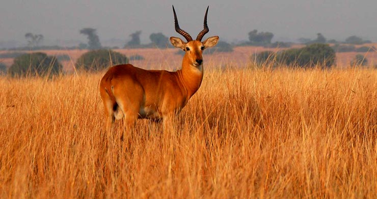
BACKGROUND Toro Semliki Wildlife Reserve was established as a game reserve in 1926 and was among the first protected areas to be gazetted. The main reason was to protect the large numbers of Uganda Kobs in the area. It covers an area of 542 km2. It is located in western Uganda, within Ntoroko and Kabarole...Read More
Recent Posts
- Ti Euro Bonus Minus Indskud Casino August ️ Adlerslots
- 10 Nft Stocks To Get According To Reddit
- Ledus kazino 25 eiro atlaide bez depozīta vai 50 bezmaksas griezieni
- Mityczny automat Maiden w Ice Casino sprawi, że Twoje serce zabije i zadrży dzięki hojnym wypłatom
- Ggbet Sport i e-sport! Mod Apk V1 9 Darmowe pobieranie
Archives
- October 2022
- September 2022
- August 2022
- May 2022
- April 2022
- March 2022
- February 2022
- January 2022
- December 2021
- November 2021
- October 2021
- September 2021
- August 2021
- July 2021
- May 2021
- April 2021
- February 2021
- January 2021
- August 2020
- July 2020
- June 2020
- May 2020
- April 2020
- November 2019
- October 2019
- September 2019
- June 2016
Categories
- ACCOMMODATION
- ACTIVITIES AND ATTRACTIONS
- Best time to travel to Kenya
- BIRDING
- Bitcoin News
- Bitcoin Price
- Bitcoin Trading
- Blog
- BOAT LAUNCH
- Bookkeeping
- BUDGETING RWANDA
- BUSH CAMPING
- Bwindi Gorilla Trekking
- Caves
- CHIMPANZEE TRACKING AND HABITUATION
- Coastal Safari
- Cryptocurrency service
- CULTURAL ENCOUNTERS
- CYCLING AND MOUNTAIN BIKING
- Education
- EXPERIENTIAL TOURISM
- GAME DRIVES
- GORILLA TRACKING
- Gorilla Trekking in Uganda
- Holiday Styles and Options in Kenya
- Installment Loans
- IT Образование
- Kenya
- Kilmanjaro
- Masonry
- Medical
- MOUNTAIN AND VOLCANO CLIMBING
- National Parks In Kenya
- National Parks In Uganda
- News
- Northern Circuit
- Payday Loans
- Post Format
- SAFARI & HOLIDAY STYLES IN RWANDA
- See Kenya in Your Comfort
- Software development
- Southern Park
- SPORT FISHING | UGANDA
- THE BASICS RWANDA
- THe HIGHLIGHTS RWANDA
- Top News
- TRAVEL ADVICE
- TYPE OF TRAVELLER IN RWANDA
- Uncategorized
- Western Tanzania
- What You Need To Know About Kenya
- WHEN TO GO TO RWANDA
- WHERE TO IN RWANDA
- Who is Travelling to Kenya with you?
- Why Rwanda
- Wild Life Reserves
- Криптовалюты

